travel
The Ultimate Guide to Crater Lake Hikes: Best Trails, Stunning Views, and Essential Tips
Published
3 weeks agoon

Table of Contents
ToggleBest Trails, Stunning Views, and Essential Tips
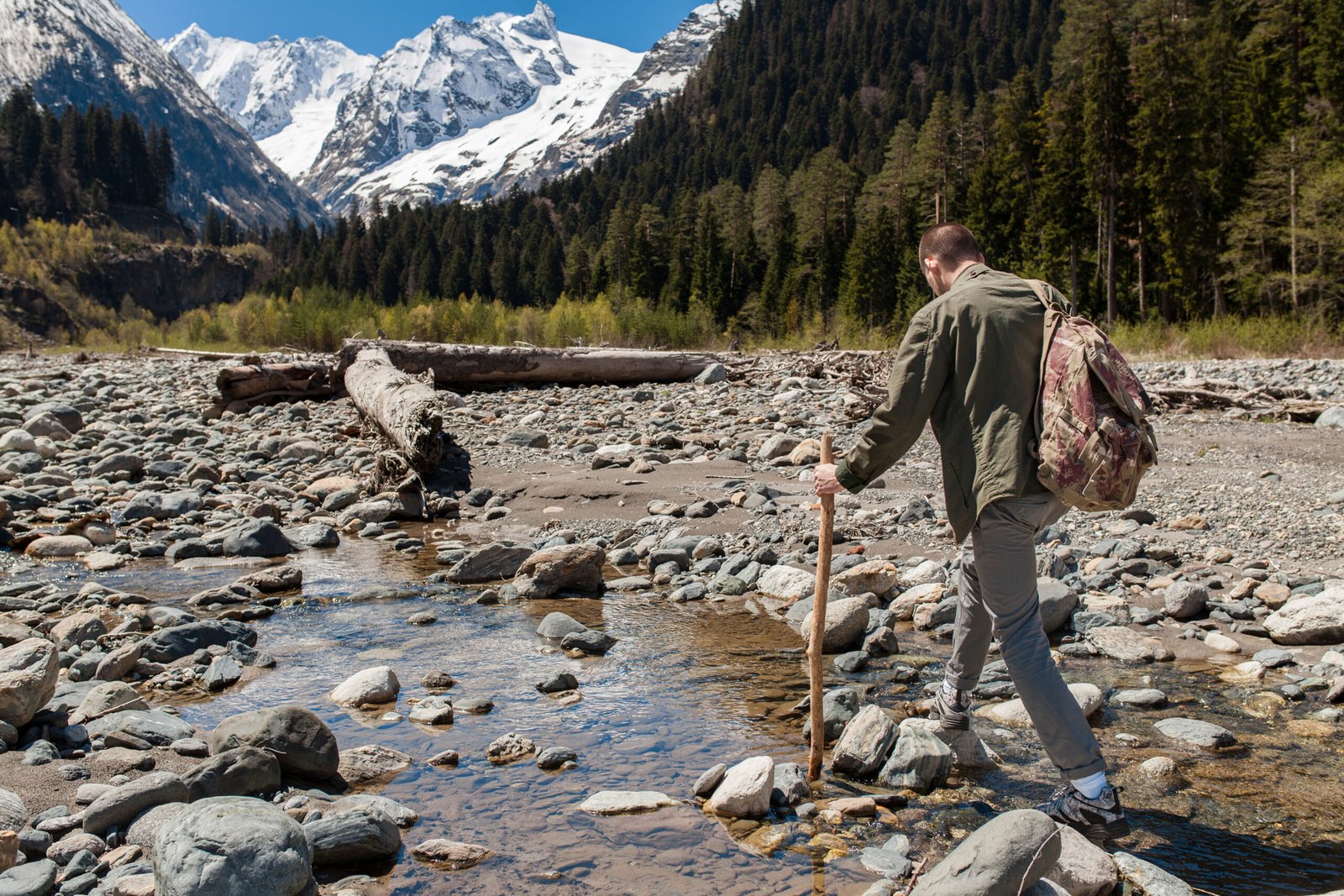
Crater Lake National Park in southern Oregon is home to one of the most awe-inspiring natural wonders in the United States. Formed approximately 7,700 years ago when the volcanic Mount Mazama collapsed into itself, this caldera now holds the deepest lake in the United States and one of the clearest in the world . The park’s diverse trail system offers opportunities for hikers of all skill levels, from casual nature walkers to seasoned backcountry adventurers. With over 100 miles of hiking trails traversing old-growth forests, pumice meadows, and volcanic landscapes, exploring Crater Lake on foot provides unparalleled access to its stunning blue waters and dramatic rim views . This guide explores the best Crater Lake hikes, detailing what each trail offers so you can choose the perfect adventure.
Trail Difficulty and Preparation
Before hitting the trails, it’s important to understand that all hikes in Crater Lake National Park begin above 4,000 feet in elevation, with many rim trails starting around 7,100 feet . This high altitude can affect visitors, making even moderate trails feel more strenuous. The park’s weather is also famously unpredictable, and trails at higher elevations often remain snow-covered into early July . Hikers should carry plenty of water, as reliable sources are limited on most rim trails, and wear sturdy footwear to navigate the loose volcanic rock common throughout the park . Checking trail conditions at the visitor center before heading out is always recommended.
Best Crater Lake Hikes for Easy and Accessible Exploration
For those seeking less strenuous experiences or traveling with family members of varying abilities, Crater Lake offers several easy and accessible trails that still provide breathtaking scenery. The Plaikni Falls Trail is a delightful 2-mile round-trip stroll through a forest leading to a 40-foot waterfall fed by snowmelt . This trail is particularly beautiful in season when the meadows burst with colorful wildflowers, and it is accessible to all-terrain wheelchairs except for the final quarter-mile . Similarly, The Pinnacles Valley Trail offers a brief and easy 0.8-mile forest walk above a canyon filled with fascinating volcanic spires called pinnacles . These geological formations were created when hot ash filled the valley and gases escaped, causing the surrounding material to harden and resist erosion . This trail is also accessible to all-terrain wheelchairs. The Sun Notch Trail provides a short, 0.8-mile loop that walks uphill through a grassy meadow to a stunning view of the lake, including the Phantom Ship rock formation, making it an excellent choice for a quick and rewarding walk .
Moderate Hikes Offering Classic Crater Lake Vistas
For hikers looking for a bit more of a challenge without committing to a full-day trek, the moderate trails around the rim deliver exceptional views. The Watchman Peak Trail is an extremely popular 1.6-mile round-trip hike that ascends to an old fire lookout offering 360-degree panoramic views of Crater Lake and its surrounding landscape . This trail is especially renowned as one of the best places in the park to catch a spectacular sunset, though hikers should bring a headlamp if planning to descend after dark . Another classic moderate hike is the Garfield Peak Trail, a 3.5-mile out-and-back trek that begins near the historic Crater Lake Lodge . The trail climbs to the summit of Garfield Peak, offering sweeping vistas of the lake, the Cascade Range peaks, and wildflower-covered slopes along the way . The Discovery Point Trail is an easy-to-moderate 2-mile hike along the west rim of the lake, traversing an old-growth forest shaped by the wind . This trail begins where the paved walk in Rim Village ends and is an excellent choice for families seeking continuous lake views .
Strenuous Summit Hikes for the Ultimate Reward
Adventurous hikers seeking the most dramatic perspectives and physical challenges will find the strenuous trails deeply rewarding. The most iconic of these is the Mount Scott Trail, which climbs to the park’s highest point at 8,929 feet . This 4.4-mile round-trip hike offers a gradual ascent with alpine wildflowers along the way and culminates at the base of a fire lookout tower, providing the only view of the entire lake from within the park . The trail is best hiked in the morning when the light is ideal for viewing the deep blue waters of the lake below . The Crater Peak Trail presents a different type of challenge, a 6.5-mile round-trip hike to the summit of a small volcano . While this trail does not offer views of Crater Lake itself, it provides sweeping views of the Klamath Basin and Union Peak, making it a rewarding and generally less crowded option for those seeking a peaceful walk through forests and waving grasslands . For an even more remote and strenuous undertaking, the Union Peak Trail, at nearly 10 miles round-trip, is the longest maintained trail in the park . It leads through diverse terrains including forests and pumice meadows, with a very steep final climb to a rocky summit that provides 360-degree panoramic views .
Important Closure: Cleetwood Cove Trail
A crucial note for anyone planning a trip is that the Cleetwood Cove Trail, which provides the only legal access to the shoreline of Crater Lake, is closed for significant repairs and upgrades starting in 2026 . This closure means that boat tours will not be available, and the trailhead’s parking lot will be inaccessible. The trail is expected to remain closed until 2029, when it will reopen with safer, more stable terrain and a brand-new dock . While this closure impacts lake access, the vast majority of the park’s other trails remain open and continue to offer awe-inspiring experiences.
Backcountry Hikes and Multi-Day Adventures
For those who wish to immerse themselves fully in the park’s wilderness, Crater Lake offers several backcountry hikes and multi-day backpacking trips. Much of this network connects with segments of the Pacific Crest Trail (PCT), with approximately 33 miles of it passing through the park . These routes allow backpackers to experience remote areas of the park and stay at designated backcountry campsites. One iconic excursion is a 33-mile, three-day circumnavigation of the lake, which follows portions of the Rim Trail and the PCT, providing a comprehensive and profound wilderness experience . A permit is required for all overnight stays in the backcountry, so planning ahead is essential .
Conclusion
Crater Lake National Park is a true hiking paradise, offering a diverse array of trails that cater to every level of adventurer. From the easily accessible beauty of Plaikni Falls to the panoramic summit views of Mount Scott, each trail provides a unique perspective on the park’s volcanic history and pristine, sapphire-blue waters. By understanding the difficulty, location, and current conditions of these trails, you can plan the perfect hike to match your fitness level and interests. Whether you’re seeking a leisurely stroll or a challenging backcountry expedition, the trails of Crater Lake promise an unforgettable journey into one of the most breathtaking landscapes in the United States.
Frequently Asked Questions
Q: What is the most popular hike in Crater Lake National Park?
A: The Cleetwood Cove Trail was historically the most popular for its access to the lake shore, but it is closed from 2026 through 2029. During this time, popular alternatives include the Watchman Peak Trail and Garfield Peak Trail for their stunning panoramic views .
Q: Is it difficult to hike at Crater Lake?
A: Trail difficulty varies widely. The park offers easy, accessible trails like the Pinnacles Valley Trail and Sun Notch Trail, as well as moderate and strenuous hikes. However, all trails begin at high elevations, which can make them feel more challenging .
Q: When is the best time to hike at Crater Lake?
A: The best time for hiking is typically from late June to mid-October, when most trails are clear of snow. However, some higher-elevation trails can have snow patches well into July. Always check current trail conditions before your visit .
Q: Can I hike down to the water at Crater Lake?
A: Currently, the only trail providing legal access to the shoreline is the Cleetwood Cove Trail, which is closed until 2029. There is no other access to the lake shore .
Q: Are there easy hikes at Crater Lake for families?
A: Yes, there are several easy and accessible trails perfect for families. The Plaikni Falls Trail, Pinnacles Valley Trail, and Sun Notch Trail are all relatively short and offer beautiful scenery with minimal elevation gain .
Q: Do I need a permit to hike in Crater Lake National Park?
A: You do not need a permit for day hikes. However, an overnight backcountry permit is required for any multi-day backpacking trips or camping outside of designated campgrounds .
You may like
travel
Manchester TN: The Complete 2026 Guide to Tennessee’s Music, History and Nature Hub
Published
7 days agoon
July 18, 2026
Table of Contents
ToggleManchester, TN is one of Tennessee’s most surprising small cities. Known around the world as the home of the Bonnaroo Music and Arts Festival, this welcoming Coffee County community offers far more than live music. From 2,000-year-old Native American history and scenic waterfalls to affordable housing and a thriving small-town atmosphere, Manchester has become one of Middle Tennessee’s most attractive destinations in 2026.
Conveniently located between Nashville and Chattanooga along Interstate 24, Manchester combines Southern hospitality, outdoor adventure, and cultural attractions. Whether you’re planning a vacation, considering relocation, or simply passing through, this guide covers everything you need to know about Manchester TN in 2026.
Where Is Manchester TN Located? Geography and Strategic Location
Manchester, Tennessee is the county seat of Coffee County in southern Middle Tennessee and is part of the Tullahoma Micropolitan Statistical Area.
One of Manchester’s biggest advantages is its location:
- 65 miles southeast of Nashville
- 75 miles northwest of Chattanooga
- Direct access via Interstate 24
- Convenient day-trip destination from both major cities
Its central location has helped Manchester become an important stop for travelers, businesses, and tourists exploring Tennessee.
The city’s landscape is equally impressive. The Little Duck River flows through Manchester, while the nearby Cumberland Plateau offers beautiful rolling hills, forests, and scenic overlooks. The area is surrounded by hardwood forests, waterfalls, rivers, and hiking trails, earning Manchester a reputation as one of Tennessee’s hidden outdoor gems.
Nature lovers appreciate how easily they can reach nearby parks, kayaking spots, wildlife areas, and some of Tennessee’s most photographed waterfalls.
The Rich History of Manchester TN
Manchester’s history stretches back thousands of years, long before European settlers arrived.
The city’s most famous historical attraction is the Old Stone Fort State Archaeological Park, located at 732 Stone Fort Drive. Despite its name, it was never a military fort. Instead, archaeologists believe it served as a massive ceremonial complex built by the Woodland culture between 1 AD and 500 AD.
Some fascinating facts include:
- Walls extend for more than one mile
- Covers approximately 50 acres
- Built nearly 2,000 years ago
- Located where the Duck River and Little Duck River meet
Modern Manchester officially began developing in the early 1800s. A post office has operated here since 1817, and the town was named after Manchester, England.
Downtown still preserves much of its historic charm, including:
- Coffee County Courthouse (built in 1871)
- Wilkinson-Keele House, an elegant Queen Anne-style residence listed on the National Register of Historic Places
Visitors interested in local history should also explore the Arrowheads/Aerospace Cultural Center at 24 Campground Road (Exit 114), where exhibits feature Native American artifacts, Civil War memorabilia, pioneer history, and aerospace displays.
Manchester TN Population, Economy and Cost of Living in 2026
Manchester continues experiencing steady population growth.
Recent 2026 estimates place the city’s population at approximately 14,092 residents, reflecting an annual growth rate of about 2.29%. During non-festival months, various estimates place the permanent population between 10,000 and 13,776, depending on city boundaries and census methodology.
The community maintains a comfortable population density of approximately 316 residents per square mile, giving it a friendly, small-town atmosphere where neighbors often know one another.
However, everything changes every June.
During the Bonnaroo Music and Arts Festival, Manchester’s population temporarily explodes to nearly 100,000 people, transforming the city into one of Tennessee’s busiest destinations for four unforgettable days.
Affordable Living
One of Manchester’s strongest selling points is affordability.
As of mid-2026:
- Median home value: approximately $272,977
- Annual home appreciation: 6.01%
- Median monthly rent: around $920
Compared to Nashville, where median home prices often exceed $450,000, Manchester remains an excellent value.
Residents also benefit from Tennessee’s lack of a state income tax, making the city even more attractive for retirees, families, entrepreneurs, and remote workers.
Major employers include:
- Coffee County Schools
- Manchester City Schools
- Kasai Manufacturing
- Great Stage Park
- Retail and tourism businesses
Manufacturing, tourism, education, healthcare, and retail continue driving the local economy.
Top Things to Do in Manchester TN
There is no shortage of attractions for visitors in 2026.
1. Bonnaroo Music and Arts Festival
Since 2002, Manchester has hosted the internationally famous Bonnaroo Music and Arts Festival at Great Stage Park.
The four-day event attracts music fans from across North America and features:
- Rock
- Country
- Americana
- Hip-hop
- EDM
- Reggae
- Indie artists
- Comedy
- Art installations
Bonnaroo generates millions of dollars for the local economy every year and has become one of America’s most recognizable music festivals.
2. Old Stone Fort State Archaeological Park
Frequently ranked the #1 attraction in Manchester, this beautiful 400-acre state park offers:
- Scenic waterfalls
- Hiking trails
- River overlooks
- Picnic areas
- Visitor museum
- Educational theater
It’s one of Tennessee’s most fascinating combinations of history and natural beauty.
3. Historic Downtown Manchester
Downtown Manchester features:
- Local boutiques
- Coffee shops
- Family-owned restaurants
- Farmers markets
- Historic courthouse square
Walking downtown offers visitors a glimpse into authentic small-town Tennessee.
4. Outdoor Recreation
Outdoor enthusiasts enjoy:
- Kayaking the Little Duck River
- Hiking to Machine Falls
- Visiting Rutledge Falls
- Exploring Barrel Springs Nature Area
- Birdwatching and photography
The area is ideal for both casual visitors and experienced hikers.
5. Arrowheads/Aerospace Museum
Located near Interstate 24, this museum offers an educational stop for families interested in archaeology, military history, Native American culture, and aerospace achievements.
Education, Healthcare and Quality of Life
Manchester consistently ranks highly for overall quality of life.
Education is provided through:
- Manchester City Schools
- Coffee County Schools
- Coffee County Central High School
Students also have convenient access to Motlow State Community College in nearby Tullahoma.
Healthcare services are anchored by Unity Medical Center, providing local medical care close to residents.
Families appreciate Manchester because of its:
- Lower crime rates
- Minimal traffic congestion
- Abundant parks and green spaces
- Strong sense of community
- Family-friendly events throughout the year
Residents enjoy annual celebrations including:
- Bonnaroo
- Christmas parades
- Friday night football
- Summer concerts
- Movies on the square
- Farmers markets
For outdoor enthusiasts, one of the city’s greatest advantages is that Old Stone Fort State Archaeological Park sits only about 13 minutes (4.8 miles) from many neighborhoods.
Best Time to Visit Manchester TN in 2026
The ideal time to visit depends on your interests.
June: Festival Season
Music lovers should plan for June, when Bonnaroo transforms Manchester into one of America’s largest music destinations.
Hotels often sell out 9 to 12 months in advance, so early reservations are essential.
Spring (April–May)
Perfect for:
- Waterfall photography
- Hiking
- Kayaking
- Wildflowers
- Comfortable temperatures
Fall (October–November)
Many locals consider autumn the most beautiful season.
Visitors can enjoy:
- Brilliant fall foliage
- Mild temperatures in the 60s°F
- Less crowded hiking trails
- Scenic drives through Coffee County
Winter (January–March)
Travelers looking for lower hotel prices and fewer crowds will find winter offers the most affordable accommodations.
Final Thoughts: Why Manchester TN Continues to Grow in 2026
Manchester TN successfully combines history, music, affordability, and outdoor adventure into one welcoming community. Whether you’re exploring the 2,000-year-old Old Stone Fort, attending the world-famous Bonnaroo Music and Arts Festival, kayaking the Little Duck River, or enjoying the charm of the historic downtown square, Manchester offers experiences that rival much larger cities.
Its strategic location between Nashville and Chattanooga, below-average cost of living, excellent schools, beautiful natural surroundings, and strong community spirit continue attracting new residents and visitors every year.
Pro Tip for 2026: If you’re driving along Interstate 24, use Exit 114 or Exit 105 to explore Manchester. Even a short stop lets you experience excellent local restaurants, unique history, scenic parks, and true Tennessee hospitality. Whether you’re staying for a weekend, attending Bonnaroo, or considering a permanent move, Manchester, Tennessee proves that some of the state’s greatest adventures are found in its most welcoming small cities.
travel
Nighthorse Lake 2026: Complete Guide to Durango’s Hidden Oasis
Published
7 days agoon
July 18, 2026
Table of Contents
ToggleIf you are searching for the best lake near Durango, Colorado for swimming, fishing, boating, kayaking, and family-friendly outdoor adventures, Nighthorse Lake should be at the top of your list in 2026. Located just two miles southwest of downtown Durango, this beautiful 1,500-acre reservoir has become one of Southwest Colorado’s premier recreation destinations.
Since opening for public recreation in 2018, Nighthorse Lake has attracted visitors with its crystal-clear water, breathtaking mountain scenery, excellent fishing, modern boating facilities, and clean swimming beach. Whether you’re planning a weekend getaway or simply looking for a relaxing day outdoors, this hidden oasis offers something for everyone.
This 2026 complete guide covers everything you need to know, including history, location, activities, fishing regulations, boating rules, swimming information, fees, hours, and expert tips.
What Is Nighthorse Lake? History, Size, and Why It’s Important
Despite its natural beauty, Nighthorse Lake is not a natural lake. It is a man-made reservoir created by the Ridges Basin Dam as part of the Animas-La Plata Water Project, a major federal water storage initiative authorized by Congress in 1968.
The project experienced more than four decades of delays due to environmental concerns, water rights disputes, and consultations with Native American tribes. Construction eventually began in 2004, the reservoir filled in 2011, and recreational access officially opened in 2018.
The lake is named after former U.S. Senator Ben Nighthorse Campbell, recognizing his contributions to Colorado and Native American communities.
Lake Facts (2026)
- Surface Area: Approximately 1,490 acres
- Recreation Area: Around 5,500 acres
- Maximum Water Storage: Over 90,000 acre-feet
- Maximum Depth: Approximately 180–270 feet in the deepest sections
- Dam Height: 270 feet
Today, Nighthorse Lake serves two important purposes:
- Water storage for Colorado, New Mexico, and tribal communities
- Outdoor recreation for thousands of annual visitors
The shoreline also protects important Native American archaeological sites, making cultural preservation an essential part of lake management. Visitors must remain within designated recreation areas and avoid entering protected shoreline zones.
Where Is Nighthorse Lake? Location, Directions, Hours, and Fees
Nighthorse Lake is located in La Plata County, just southwest of Durango, Colorado, making it one of the easiest outdoor destinations to reach from town.
GPS Address:
2787 County Road 228, Durango, CO 81301
From US-160 West, drivers simply turn onto County Road 211 (Lake Nighthorse Road). The drive usually takes only 10–15 minutes from downtown Durango.
Parking is available near:
- Boat launch
- Swimming beach
- Picnic areas
- Trailheads
During June through August, parking often fills before 10:00 AM on weekends.
2026 Visitor Tips
- No public transportation currently serves the lake.
- Cell phone coverage is limited in some areas.
- Bring drinking water, sunscreen, and shade.
- Plan to arrive early during holidays and weekends.
The recreation area generally operates from April through November, although operating dates may vary depending on weather and water conditions.
Best Things to Do at Nighthorse Lake in 2026
Managed jointly by the City of Durango and the Bureau of Reclamation, the recreation area is designed primarily for day-use visitors. Overnight camping is not permitted at the lake itself.
Swimming
The designated swimming beach features:
- Soft sandy shoreline
- Roped swimming area
- Shade structures
- Picnic tables
- Clean restrooms
The water remains cool throughout most of the season, becoming warmest during late July and August.
Boating
Nighthorse Lake welcomes:
- Motorboats
- Kayaks
- Paddleboards
- Canoes
- Fishing boats
Visitors without equipment can often rent:
- Paddleboards
- Kayaks
- Canoes
during the summer recreation season.
Hiking
The Lake Nighthorse Trail is a 2.3-mile out-and-back gravel trail suitable for nearly every fitness level.
Highlights include:
- Panoramic lake views
- San Juan Mountain scenery
- Wildlife viewing opportunities
- Beautiful sunrise and sunset photography
Wildlife Watching
Nature enthusiasts frequently spot:
- Bald eagles (especially during winter)
- Hawks
- Ospreys
- Waterfowl
- Mule deer
- Songbirds
- Desert wildlife
Picnicking
Several picnic areas overlook the water, providing peaceful spots for family lunches or afternoon relaxation. Visitors should always follow Leave No Trace principles and pack out all trash.
Fishing at Nighthorse Lake: Species, Licenses, and Expert Tips
Nighthorse Lake has quickly developed a reputation as one of Southwest Colorado’s best trout fisheries. The reservoir is regularly stocked by Colorado Parks and Wildlife (CPW).
Popular Fish Species
- Rainbow Trout — plentiful and beginner-friendly
- Brown Trout — larger, cautious fish often caught during low-light hours
- Kokanee Salmon — one of the lake’s biggest attractions
- White Suckers
- Flannelmouth Suckers
- Fathead Minnows
- Crayfish
2026 Fishing Regulations
Anyone 16 years or older must possess a valid Colorado fishing license.
Current limits include:
- 4 trout daily
- 8 trout in possession
- 10 kokanee salmon daily
- 10 kokanee in possession
Additional rules include:
- Live bait is prohibited
- Fishing is prohibited inside designated swim and Wibit areas
- Fish cleaning waste must be disposed of in trash containers
- An ADA-accessible fishing dock and pavilion are available
Best Fishing Tips
Experienced anglers recommend:
- Fishing at sunrise or sunset
- Using boats for deeper kokanee salmon
- Targeting 40–80 feet during summer
- Fishing near the dam and inlet areas from shore
Boating, Swimming, and Wibit Aqua Park Rules in 2026
Boating remains one of the biggest attractions at Nighthorse Lake, but protecting water quality is a top priority.
Motorized Boating Rules
Motorboats are allowed under strict inspection requirements designed to prevent Aquatic Nuisance Species (ANS).
Boat owners must:
- Pass a mandatory inspection before launching
- Have current boat registration
- Carry a valid Colorado Parks & Wildlife ANS Stamp
- Follow operating schedules
Motorized boating is generally permitted Thursday through Monday from 8:00 AM to 5:00 PM, subject to seasonal schedules and weather conditions.
Swimming Rules
Visitors should:
- Swim only in designated areas
- Observe lifeguard or staff instructions where applicable
- Supervise children closely
- Avoid swimming near boat traffic
Wibit Aqua Park
One of the lake’s most popular family attractions is the Wibit inflatable water park, featuring floating obstacle courses, climbing structures, slides, and balance challenges.
Safety rules include:
- Life jackets are required.
- Age and height restrictions may apply.
- Tickets are typically purchased separately.
- Capacity limits may be enforced during busy periods.
Reservations are recommended during peak summer weekends.
2026 Visitor Tips, Nearby Attractions, and Final Thoughts
A successful visit to Nighthorse Lake starts with proper planning.
Helpful Tips
- Arrive before 10:00 AM on weekends.
- Bring cash or cards for entrance fees and rentals.
- Pack sunscreen, hats, water shoes, and drinking water.
- Check weather forecasts before traveling.
- Respect wildlife and protected archaeological areas.
- Keep pets only where permitted and clean up after them.
Nearby Attractions
After enjoying the lake, visitors can easily explore:
- Historic downtown Durango
- Durango & Silverton Narrow Gauge Railroad
- Animas River Trail
- Mesa Verde National Park
- San Juan National Forest
Combining these attractions with a day at Nighthorse Lake creates an unforgettable Southwest Colorado vacation.
Conclusion
In 2026, Nighthorse Lake continues to stand out as one of Colorado’s finest outdoor recreation destinations. Its combination of clear mountain water, outstanding trout fishing, boating opportunities, scenic hiking trails, sandy swimming beach, family-friendly amenities, and spectacular San Juan Mountain views makes it an exceptional place for visitors of all ages.
Whether you’re casting for kokanee salmon, paddling across calm waters at sunrise, relaxing on the beach, or exploring nearby Durango, Nighthorse Lake offers an unforgettable Colorado experience. With proper planning, respect for the environment, and an early start during peak season, you’ll discover why this hidden oasis has become one of the region’s most beloved destinations.
travel
The Complete Guide to Lake Alvin: A South Dakota Treasure for Outdoor Enthusiasts
Published
2 weeks agoon
July 11, 2026
Table of Contents
ToggleA South Dakota Treasure for Outdoor Enthusiasts
Nestled in the rolling prairie of Lincoln County, just a short drive from the bustling city of Sioux Falls, lies Lake Alvin Recreation Area, a serene 59-acre park that offers a perfect escape into nature. This guide provides a comprehensive overview of everything you need to know about visiting Lake Alvin, from its rich history and excellent fishing to its family-friendly beach and year-round activities.
Article Titles and Keyword Analysis
Below is a list of potential titles and a breakdown of the primary and secondary keywords they target.
Primary Keyword Target: Lake Alvin
Potential Titles:
The Ultimate Guide to Lake Alvin: Fishing, Swimming, and Camping Near Sioux Falls
Exploring Lake Alvin Recreation Area: A South Dakota Family Adventure
Lake Alvin: Your Complete Guide to South Dakota’s Premier Outdoor Getaway
Fishing at Lake Alvin: A Complete Guide to Species, Tips, and More
Keyword Explanation:
Lake Alvin: The fundamental primary keyword.
Lake Alvin Recreation Area: This is the official name of the park and a key long-tail keyword. It captures users who are looking for information on the park’s amenities and facilities .
Lake Alvin South Dakota: This geo-targeted keyword is essential for attracting visitors planning a trip to the specific location in South Dakota, distinguishing it from other lakes with the same name .
Lake Alvin fishing: This is a high-intent keyword for anglers. It signals to search engines that the content covers fishing-related information, including species, regulations, and tips .
Lake Alvin camping: This keyword targets users looking for overnight accommodations.
Introduction: Your Gateway to Outdoor Adventure at Lake Alvin
Imagine a place where the clear, spring-fed waters of a 105-acre lake reflect the expansive South Dakota sky, surrounded by the rich history of the Great Plains. This is the reality of Lake Alvin Recreation Area, a beloved destination for locals and visitors alike. Situated a mere 20 minutes south of Sioux Falls, Lake Alvin provides an incredible opportunity to disconnect from the pace of city life and immerse yourself in a world of outdoor activity . The park is renowned for its sandy beach, which draws families throughout the summer, and its excellent fishing, which keeps anglers returning year after year .
The Rich History of Lake Alvin
Lake Alvin is more than just a body of water; it is a site with a fascinating history that adds depth to any visit. The lake is an artificial impoundment, created by the construction of a dam across the lower end of Nine Mile Creek . Construction of this earthfill dam was completed in August 1954, and the lake reached its full pool by 1957 . However, the name “Alvin” does not come from the creek or the landscape, but rather from a local hero. The lake and the surrounding recreation area were named in honor of Alvin Dempewolf, the only World War I soldier from the nearby town of Harrisburg who died overseas . This dedication adds a poignant layer of history to the site, transforming it into a lasting memorial.
Year-Round Activities at Lake Alvin Recreation Area
A Premier Destination for Fishing Enthusiasts
For many, Lake Alvin is synonymous with exceptional fishing. The lake is home to a diverse and healthy fish population, making it a prime spot for both novice and experienced anglers. Anglers can expect to catch a variety of species, including walleye, northern pike, crappie, sunfish, yellow perch, catfish, and bullheads . The lake’s classification as a warmwater permanent fish propagation area supports this thriving ecosystem . To ensure a high-quality fishing experience, the South Dakota Game, Fish and Parks department actively manages the fish populations through periodic stockings of species like walleye and largemouth bass . The 105-acre lake is the perfect size for any boat and motor; however, it is designated as a no-wake zone.
Summer Fun and Family Activities
When the South Dakota sun is shining, Lake Alvin becomes a hub of family-friendly activity. The park is best known for its excellent beach facilities, which include a designated swimming beach with a sandy shoreline . It is one of the few swimming lakes in the Sioux Falls area, making it an incredibly popular spot for families looking to cool off on a hot summer day.
Hiking and Wildlife Viewing
While water recreation is the main focus, Lake Alvin also offers opportunities to explore the surrounding prairie and woodland habitats. A number of hiking trails wind through the park and the adjacent Lake Alvin Game Production Area, allowing visitors to stretch their legs and observe the local wildlife . The area is home to white-tailed deer, wild turkeys, and great blue herons, which are commonly sighted along the shores . For birdwatchers, the mix of woodland and prairie habitat offers a rich diversity of species, especially during spring and fall migrations when waterfowl pass through the area . The natural landscape of the Big Sioux River valley, where the eastern woodlands meet the Great Plains, creates a unique ecosystem that is well worth exploring on foot .
Winter Activities: Ice Fishing and More
The recreation at Lake Alvin does not end when the temperature drops. During the winter months, the lake transforms into a popular destination for ice fishing and cross-country skiing . The same species that attract anglers in the summer, such as walleye, northern pike, and crappie, are available through the ice, providing a unique and exciting cold-weather challenge . The park remains open year-round, allowing visitors to enjoy the quiet solitude of a South Dakota winter landscape.
Frequently Asked Questions (FAQ)
Where is Lake Alvin located?
Lake Alvin Recreation Area is located in Lincoln County, South Dakota, approximately 13 miles southeast of Sioux Falls . The physical address is 27225 480th Avenue, Harrisburg, SD 57032 .
How large is Lake Alvin?
Lake Alvin is a 105-acre lake . The surrounding Lake Alvin Recreation Area encompasses 59 acres .
What kind of fish can be found in Lake Alvin?
Lake Alvin offers excellent fishing for a variety of species, including walleye, northern pike, crappie, bluegill, sunfish, yellow perch, largemouth bass, and catfish .
Can I swim at Lake Alvin?
Yes, Lake Alvin has a designated sandy swimming beach that is open during the summer months. Lifeguards are typically on duty during this time, making it a popular and safe spot for families .
Is there a boat ramp at Lake Alvin?
Yes, there is a concrete boat ramp available for public use . However, the entire lake is a designated no-wake zone, meaning all boats must not exceed 5 mph .
Are there camping facilities at Lake Alvin?
It is recommended to check with the South Dakota Game, Fish, and Parks department for specific camping regulations and availability.
How deep is Lake Alvin?
The maximum depth of Lake Alvin is approximately 21 to 26 feet, with an average depth of around 9 feet .
Conclusion: Why Lake Alvin is a Must-Visit Destination
Lake Alvin Recreation Area is a testament to the fact that you do not need to travel far to find a world-class outdoor experience. Its proximity to Sioux Falls, combined with its pristine waters, diverse recreational opportunities, and rich history, makes it a truly special place . Whether you are an avid angler, a family looking for a safe swimming spot, a hiker seeking tranquility, or a history buff interested in the area’s past, Lake Alvin has something to offer everyone. The park’s well-maintained facilities, from its sandy beach and boat ramp to its picnic shelters and hiking trails, ensure a comfortable and enjoyable visit for all ages. Plan your visit today and discover why this small but mighty recreation area is so beloved by all who visit.

Classroom 15X: The Complete Guide to Unblocked Games, Learning Models, and Modern Education

Recorder Notes: The Ultimate Guide to Capturing, Organizing, and Leveraging Audio for Success

The Enduring Allure of Gut Strings Violin: A Comprehensive Guide to Tone, Tradition, and Technique

Obituary Template: How to Write a Meaningful Tribute with Free Examples

A Journey Through Time: A Deep Dive into “Отмороженные” 1 Season 4 Series

Flower Background: The Complete Guide to Creating Stunning Floral Visuals That Transform Any Space
Trending
Fashion4 weeks agoObituary Template: How to Write a Meaningful Tribute with Free Examples
Entertainment3 weeks agoA Journey Through Time: A Deep Dive into “Отмороженные” 1 Season 4 Series
Fashion4 weeks agoFlower Background: The Complete Guide to Creating Stunning Floral Visuals That Transform Any Space
Fashion4 weeks agoBaddiesHun: The Complete Guide to the Viral Digital Lifestyle, Fashion & Self-Expression Trend
Fashion4 weeks agoPicture Black Picture: Meaning, Uses, Psychology, Aesthetics, and Why Black Images Still Captivate Us
Fashion4 weeks agoMary Ryan Ravenel: The Private Life, Career, and Story Behind Thomas Ravenel’s First Wife
Fashion4 weeks agoBobbye Brooks Oliver: The Quiet Life Behind a Hollywood Name
Fashion3 weeks agoLife Without Sara Amat: A Deep Dive into Nostalgia, First Love, and the End of Innocence